Farmington Bay Wetlands
excerpted from our book
Salt Lake City's Incredible Hiking and Biking Trails
pages 249-252
|
Buy book directly from the author!
Salt Lake City's Incredible Hiking and Biking Trails
- has access info for 73 trailheads
- 73 colorful trail maps
- 325 full color photographs
- loads of hiking tips
|
regularly $19.95
now on sale for only
$9.95
click here
for book orders
|


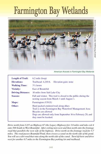
 The Farmington Bay Wetlands on the eastern shore of the Great Salt Lake
is one of the most important refuges for migrating birds in the
United States. Millions of birds visit these wetlands during the migration and nesting seasons each year, and more than 200 individual species have been
identified in the area. The lakeshore is a birder’s paradise. The state of Utah maintains five
other major wildlife management areas along the Great Salt Lake’s eastern
shore to protect the birds and their habitats, but one of the best places to see the birds is the Farmington Bay Waterfowl Management Area,
or Farmington Bay Wetlands, just west of
the cities of Farmington and West Bountiful.
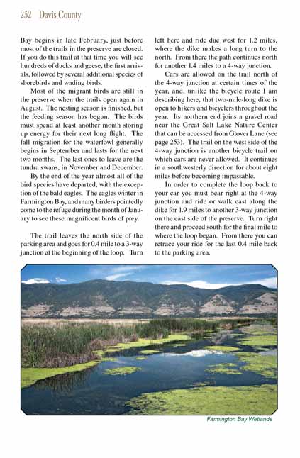
The 18,000-acre Farmington Bay Waterfowl Management Area contains a variety of wetland habitats, including fresh and saltwater ponds and marshes as well as
flatlands and open saltwater, all designed to fill the special feeding and nesting needs of the many species of birds that visit the area. Work on a complex
irrigation system began in 1935 under the direction of the Civilian Conservation Corps (CCC) and today is managed by the Utah Division of Wildlife Resources.
The preserve contains 22 miles of dikes and 126 water control structures that manipulate the flow of water from the Jordan River and other smaller creeks
into and out of the various habitats.
The best way to see the waterfowl is to walk or bicycle along the dikes
of the Farmington Bay Wetlands. Most of the dikes have roads or bike trails on them, and
they are very popular among people who enjoy watching the birds. Many walks and rides are possible, but one of my favorites is the 6.3-mile loop I will
describe here. I prefer to do this trail as a bicycle ride rather than a walk. The trail is not paved, but it is smooth and relatively hard packed for
easy riding. It is also absolutely flat and straight-perfect for families with children-and you can count on seeing many, many birds along the way.
Furthermore, the trail is closed to cars.
You will be disappointed to know, however, that the trail is not open during spring and early summer. That is the nesting season for many of the species
in the Farmington Bay Wetlands, and they require additional protection during those months. The trail is open to visitors only from August 1 through February 29 between
8:00 am and 5:00 pm. Also, be aware that there is no shade whatsoever along the trail, and it can get extremely hot in Utah in late summer. If you are
doing this hike or ride in August you had better do it early or late in the day.
The spring migration into the Farmington Bay
Wetlands begins in late February, just before most of the trails in the preserve are closed. If you do this trail at that
time you will see hundreds of ducks and geese, the first arrivals, followed by several additional species of shorebirds and wading birds.
Most of the migrant birds are still in the
Farmington Bay Wetlands when the trails open again in August. The nesting season is finished, but the feeding season has begun.
The birds must spend at least another month storing up energy for their next long flight. The fall migration for the waterfowl generally begins in September
and lasts for the next two months. The last ones to leave are the tundra swans, in November and December.
By the end of the year almost all of the bird species have departed, with the exception of the bald eagles. The eagles winter in
the Farmington Bay Wetlands, and many
birders pointedly come to the refuge during the month of January to see these magnificent birds of prey.
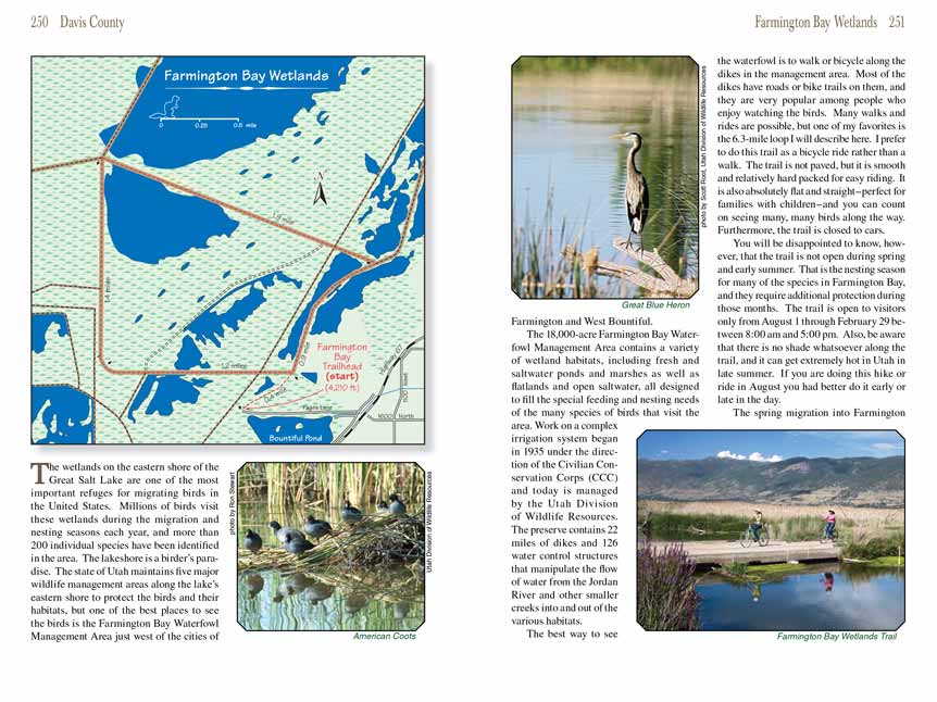
The trail leaves the north side of the parking area and goes for 0.4 mile to a 3-way junction at the beginning of the loop. Turn left here and ride due west
for 1.2 miles, where the dike makes a long turn to the north. From there the path continues north for another 1.4 miles to a 4-way junction.
Cars are allowed on the trail north of the 4-way junction at certain times of the year, and, unlike the bicycle route I am describing here, that two-mile-long
dike is open to hikers and bicyclers throughout the year. Its northern end joins a gravel road near the Great Salt Lake Nature Center that can be accessed
from Glover Lane (see page 253). The trail on the west side of the 4-way junction is another bicycle trail
into the Farmington Bay Wetlands on which cars are never allowed. It continues
in a southwesterly direction for about eight miles before becoming impassable.
In order to complete the loop back to your car you must bear right at the 4-way junction and ride or walk east along the dike for 1.9 miles to another 3-way
junction on the east side of the preserve. Turn right there and proceed south for the final mile to where the loop began. From there you can retrace your
ride for the last 0.4 mile back to the parking area.
Note to web developers: You may copy this material onto your site, but in return please include a link to my home page
www.utahtrails.com. Thank you, David Day (utahdavidday at gmail.com)
Click here to see more
trails near Salt Lake City
© Rincon Publishing Company, all rights reserved
|


 The Farmington Bay Wetlands on the eastern shore of the Great Salt Lake
is one of the most important refuges for migrating birds in the
United States. Millions of birds visit these wetlands during the migration and nesting seasons each year, and more than 200 individual species have been
identified in the area. The lakeshore is a birder’s paradise. The state of Utah maintains five
other major wildlife management areas along the Great Salt Lake’s eastern
shore to protect the birds and their habitats, but one of the best places to see the birds is the Farmington Bay Waterfowl Management Area,
or Farmington Bay Wetlands, just west of
the cities of Farmington and West Bountiful.