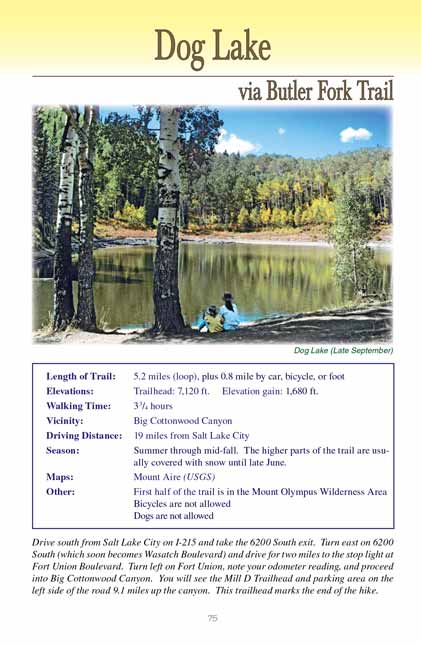
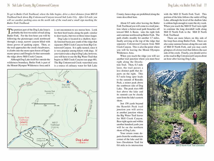
Dog Lake
via Butler Fork Trail
excerpted from our book
Salt Lake City's Incredible Hiking and Biking Trails
pages 75-77
|
Buy book directly from the author!
Salt Lake City's Incredible Hiking and Biking Trails
- has access info for 73 trailheads
- 73 colorful trail maps
- 325 full color photographs
- loads of hiking tips
|
regularly $19.95
now on sale for only
$9.95
click here
for book orders
|


The prettiest part of the Dog Lake loop is probably the first two miles of trail along Butler Fork. For the first hour you will be
following the picturesque creek northward through a steep, narrow canyon filled with dense groves of quaking aspen. Then, as the trail approaches the creek's
headwaters, it climbs into the more open forest of Engelmann spruce and Douglas fir that surrounds the ridge above Mill Creek Canyon.
Although Dog Lake itself lies outside the wilderness boundary, Butler Fork is part of the Mount Olympus Wilderness Area and it is not uncommon to see moose
here. Look for their hoof tracks along the path-similar to deer tracks, but two or three times larger.
Dog Lake is located in a shallow, heavily forested basin just south of the ridge that separates Mill Creek Canyon from Big Cottonwood Canyon. It is aptly named,
since it is very popular among hikers with dogs. If you want to take a dog to Dog Lake, however, you will have to use the Big Water Trail that begins in Mill
Creek Canyon (see page 68). The Big Cottonwood Creek watershed area is a source of culinary water for Salt Lake County; hence dogs are prohibited along the
route described here.
About 0.5 mile after leaving the Butler Fork Trailhead you will come to a trail junction where a better-used path branches off toward Mill A Basin; take the right
fork and continue northward up Butler Fork. The path climbs steadily for another 1.7 miles, finally arriving at the top of the ridge that separates Cottonwood
Canyon from Mill Creek Canyon. This is also the point where you will be leaving the Mount Olympus Wilderness Area.
When you reach the ridge you will see another trail junction where you must bear right along the Desolation Trail. Then, 0.3 mile later, the trail passes a less
distinct path that departs on the right. This 0.7-mile-long spur leads to the summit of Renolds Peak, a minor peak above the southwest side of Dog Lake. The
peak rises 680 feet above the lake and its summit can be clearly seen from the lake's eastern shore.
Just 150 yards beyond the Renolds Peak trail junction you will arrive at another junction where the Big Water Trail leaves for Mill Creek Canyon. Bear right
again and within another hundred yards you will be on the northern shore of Dog Lake.
Your return route departs from the southeastern corner of the lake and follows Desolation Trail for 0.6 mile to its intersection with the Mill D North Fork Trail.
This portion of the hike follows the outlet of Dog Lake, although the level of the shallow lake is seldom high enough to water the dry wash. When you reach the
Mill D Trail turn right to continue the long downhill walk along Mill D North Fork to the Mill D North Fork Trailhead.
There are more hikers on this side of the loop than along Butler Fork. There are also some summer homes along the east side of Mill D North Fork, and you may
catch glimpses of a lower trail that follows the east side of the creek. Finally, you should arrive at the road in Big Cottonwood Canyon about an hour after
leaving Dog Lake.
Note to web developers: You may copy this material onto your site, but in return please include a link to my home page
www.utahtrails.com. Thank you, David Day (utahdavidday
at gmail.com)
Click here to see more
trails near Salt Lake City
© Rincon Publishing Company, all rights reserved
|

