Cecret Lake Trail
excerpted from our book
Salt Lake City's Incredible Hiking and Biking Trails
pages 114-117
|
Buy book directly from the author!
Salt Lake City's Incredible Hiking and Biking Trails
- has access info for 73 trailheads
- 73 colorful trail maps
- 325 full color photographs
- loads of hiking tips
|
regularly $19.95
now on sale for only
$9.95
click here
for book orders
|


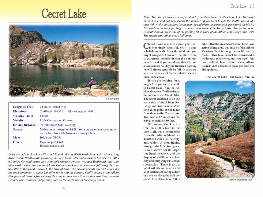
 Cecret Lake is a rare alpine gem that is stunningly beautiful, yet it is only a half-hour walk from the road. As you might imagine,
however, the short hike is extremely popular during the summer months, and if you are doing this hike on a weekend or holiday the trailhead parking lot will almost
certainly be full. In that case you can make use of the free shuttle service mentioned above.
If you are looking for a longer hike you can also walk to Cecret Lake from the Albion Meadows Trailhead near the bottom of the Alta ski lifts. The lower trailhead
is on the north side of the Albion Day Lodge and Grill, near the shuttle pick-up point; the distance from there to the Cecret Lake Trailhead is 1.5 miles and the
elevation gain is 880 feet.
Of course, the key attraction of this hike is the lake itself, but a longer hike from the Albion Meadows Trailhead can also be very enjoyable. Albion Basin, through
which the trail goes, is well known for its large, tree-lined meadows, and the display of wildflowers in late July and early August is often spectacular. There is
also a lot of wildlife in the area and your chances of seeing a deer or a moose along the trail are good. One detraction of this hike is that the area below
Cecret Lake is an active skiing area, and much of the Albion Meadows Trail is along the ski lift service roads. This hike cannot be considered a wilderness
experience, and you won’t find much solitude here. Nevertheless, Albion Basin is such a beautiful place you won’t be disappointed.
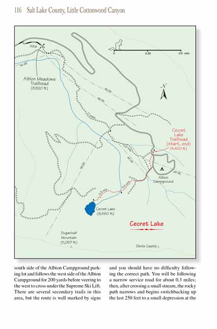
The Cecret Lake Trail leaves from the south side of the Albion Campground parking lot and follows the west side of the Albion Campground for 200 yards before
veering to the west to cross under the Supreme Ski Lift. There are several secondary trails in this area, but the route is well marked by signs and you should
have no difficulty following the correct path. You will be following a narrow service road for about 0.3 miles; then, after crossing a small stream, the rocky
path narrows and begins switchbacking up the last 250 feet to a small depression at the foot of Sugarloaf Mountain. This part of the trail is very scenic.
The elevation is close to timberline, which means there are few trees to impede the great views back into Albion Basin.
When the short climb is finished and you cross over the last bit of high ground the lake will suddenly appear before you: an alpine treasure, 150 yards across
with a backdrop of three prominent mountain peaks behind it. Sugarloaf Peak lies just 500 yards south of Cecret Lake, while Devils Castle is 0.6 mile further
east along the ridge and Mount Baldy is 0.7 mile further to the west. The Cecret Lake Trail is often used as an approach route for climbing the three peaks.
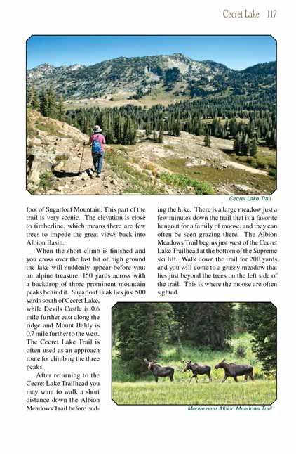
After returning to the Cecret Lake Trailhead you may want to walk a short distance down the Albion Meadows Trail before ending the hike. There is a large meadow
just a few minutes down the trail that is a favorite hangout for a family of moose, and they can often be seen grazing there. The Albion Meadows Trail begins
just west of the Cecret Lake Trailhead at the bottom of the Supreme ski lift. Walk down the trail for 200 yards and you will come to a grassy meadow that lies
just beyond the trees on the left side of the trail. This is where the moose are often sighted.
Note to web developers: You may copy this material onto your site, but in return please include a link to my home page
www.utahtrails.com. Thank you, David Day (utahdavidday at gmail.com)
Click here to see more
trails near Salt Lake City
© Rincon Publishing Company, all rights reserved
|


 Cecret Lake is a rare alpine gem that is stunningly beautiful, yet it is only a half-hour walk from the road. As you might imagine,
however, the short hike is extremely popular during the summer months, and if you are doing this hike on a weekend or holiday the trailhead parking lot will almost
certainly be full. In that case you can make use of the free shuttle service mentioned above.