The Roubideau Special Management Area was named after a
colorful French Canadian fur trapper named Antoine Roubideau who in 1828
became one of the first white men to enter the area. Roubideau entered
southwestern Colorado along the Gunnison River, where he later established
the Fort Uncompahgre fur trading station. His fort still stands today. It
can be seen in the town of Delta, five miles east of the confluence of the
Gunnison River and Roubideau Creek.
More recently the upper reaches of Roubideau Creek have
been used as a summer pasture for sheep ranchers; the first half of this
hike goes through a dense aspen forest where sheep have been grazed for at
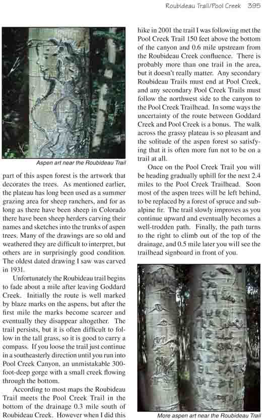
least a hundred years. It was once a tradition among Basque sheepherders to
carve elaborate drawings on the trunks of aspen trees during their long days
of solitude, and the forests in the Roubideau Area abound with such
drawings. Seeing the old drawings and the flowery signatures that accompany
them is one of the key attractions of this hike.
In 1993 the US Congress debated a proposal to include
Roubideau Creek in a new wilderness area, but unfortunately disputes over
water use prevented that from happening. Nevertheless, the upper reaches of
Roubideau Creek did receive some protection in the Colorado Wilderness Act
of that year. As a compromise, the drainage was designated the Roubideau
Special Management Area, so that now there are restrictions against logging,
mining, and motorized vehicles in 19,650 acres of land surrounding the
creek.
For the first 0.5 mile the trail winds pleasantly
along the top of the Uncompahgre Plateau through an open forest of aspen
and lots of wildflowers. Then it turns south, over what looks to be the
remains of an old wagon road, and switchbacks down into Goddard Creek
Canyon. After loosing some 200 feet of elevation the trail turns east
and continues to work its way down the north side of the creek. Finally,
1.3 miles from the trailhead, the path crosses Goddard Creek and climbs
out to a plateau south of the ravine.
In my opinion the next 2.0 miles are the most
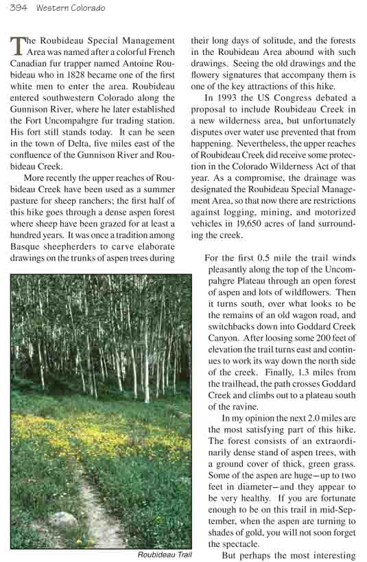
satisfying part of this hike. The forest consists of an extraordinarily
dense stand of aspen trees, with a ground cover of thick, green grass.
Some of the aspen are huge-up to two feet in diameter-and they appear to
be very healthy. If you are fortunate enough to be on this trail in
mid-September, when the aspen are turning to shades of gold, you will
not soon forget the spectacle.
But perhaps the most interesting part of this aspen
forest is the artwork that decorates the trees. As mentioned earlier, the
plateau has long been used as a summer grazing area for sheep ranchers, and
for as long as there have been sheep in Colorado there have been sheep
herders carving their names and sketches into the trunks of aspen trees.
Many of the drawings are so old and weathered they are difficult to
interpret, but others are in surprisingly good condition. The oldest dated
drawing I saw was carved in 1931.
Unfortunately the Roubideau trail begins to fade about a
mile after leaving Goddard Creek. Initially the route is well marked by
blaze marks on the aspens, but after the first mile the marks become scarcer
and eventually they disappear altogether. The trail persists, but it is
often difficult to follow in the tall grass, so it is good to carry a
compass. If you loose the trail just continue in a southeasterly direction
until you run into Pool Creek Canyon, an unmistakable 300-foot-deep gorge
with a small creek flowing through the bottom.
According to most maps the Roubideau Trail meets the Pool
Creek Trail in the bottom of the drainage 0.3 mile south of Roubideau Creek.
However when I did this hike in 2001 the trail I was following met the Pool
Creek Trail 150 feet above the bottom of the canyon and 0.6 mile upstream
from the Roubideau Creek confluence. There is probably more than one trail
in the area, but it doesn’t really matter. Any secondary Roubideau Trails
must end at Pool Creek, and any secondary Pool Creek Trails must follow the
northwest side to the canyon to the Pool Creek Trailhead. In some ways the
uncertainty of the route between Goddard Creek and Pool Creek is a bonus.
The walk across the grassy plateau is so pleasant and the solitude of the
aspen forest so satisfying that it is often more fun not to be on a trail at
all.
Once on the Pool Creek Trail you will be heading gradually uphill for the
next 2.4 miles to the Pool Creek Trailhead. Soon most of the aspen trees
will be left behind, to be replaced by a forest of spruce and subalpine fir.
The trail slowly improves as you continue upward and eventually becomes a
well-trodden path. Finally, the path turns to the right to climb out of the
top of the drainage, and 0.5 mile later you will see the trailhead signboard
in front of you.

