Maze Overlook Trail
excerpted from our book
Canyonlands National Park
Favorite Jeep Roads & Hiking Trails
pages 242-245
|
Buy book directly from the author!
Canyonlands National Park
Favorite Jeep Roads & Hiking Trails
- has access info for 75 trailheads
- 56 detailed trail maps
- 241 photographs
- loads of driving and hiking tips
|
regularly $14.95
now on sale for only
$11.95
click here
for book orders
|
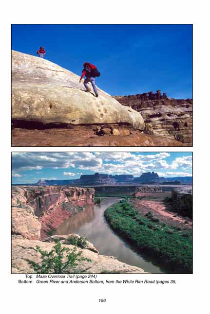
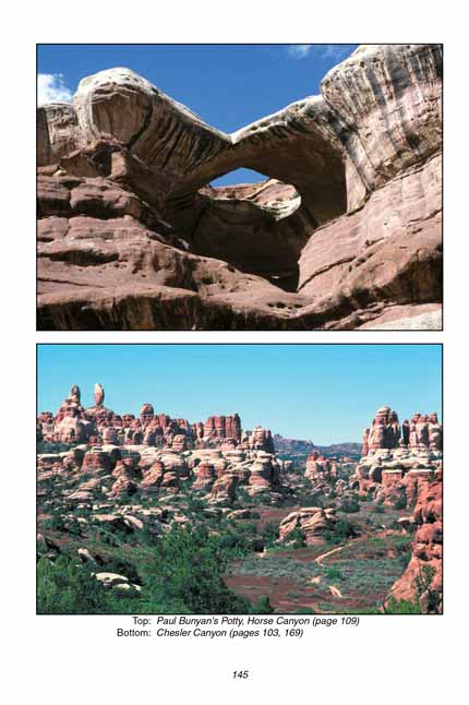
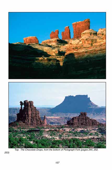
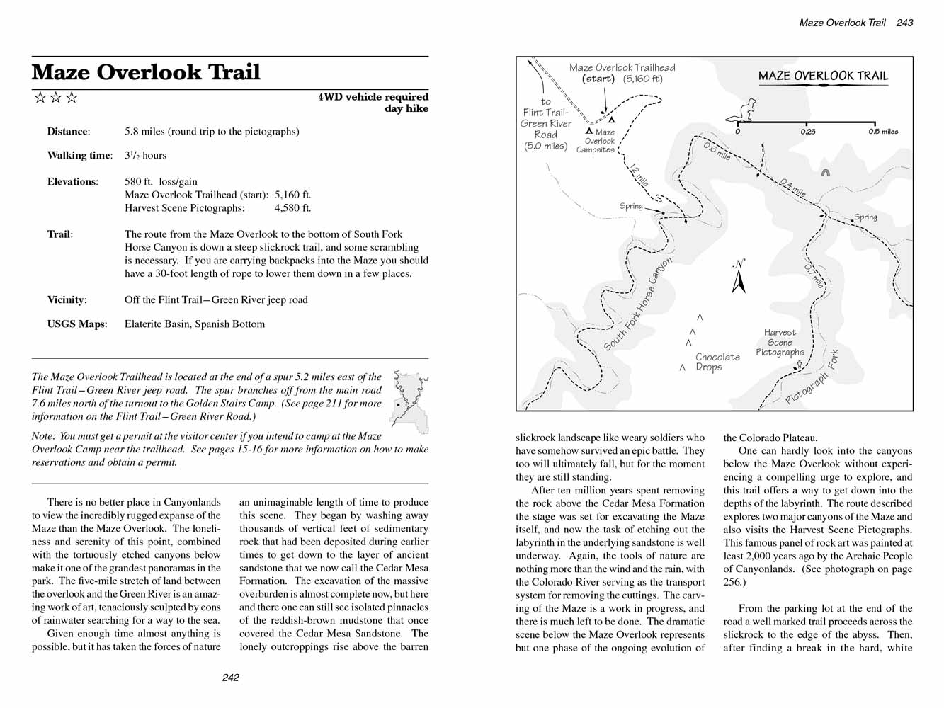 There is no better place in Canyonlands National Park to view the incredibly rugged expanse of the Maze than the Maze Overlook.
The loneliness and serenity of this point, combined with the tortuously etched canyons below make it one of the grandest panoramas in the park.
The five-mile stretch of land between the overlook and the Green River is an amazing work of art, tenaciously sculpted by eons of rainwater searching for a way to the sea.
Given enough time almost anything is possible, but it has taken the forces of nature an unimaginable length of time to produce this scene.
They began by washing away thousands of vertical feet of sedimentary rock that had been deposited during earlier times to get down to the layer of ancient sandstone that we now call the Cedar Mesa Formation.
The excavation of the massive overburden is almost complete now, but here and there one can still see isolated pinnacles of the reddish-brown mudstone that once covered the Cedar Mesa Sandstone.
The lonely outcroppings rise above the barren slickrock landscape like weary soldiers who have somehow survived an epic battle.
They too will ultimately fall, but for the moment they are still standing.
After ten million years spent removing the rock above the Cedar Mesa Formation the stage was set for excavating the Maze itself,
and now the task of etching out the labyrinth in the underlying sandstone is well underway.
Again, the tools of nature are nothing more than the wind and the rain, with the Colorado River serving as the transport system for removing the cuttings.
The carving of the Maze is a work in progress, and there is much left to be done. The dramatic scene below the Maze Overlook represents but one phase of the ongoing evolution of the Colorado Plateau.
One can hardly look into the canyons below the Maze Overlook without experiencing a compelling urge to explore, and this trail offers a way to get down into the depths of the labyrinth.
The route described explores two major canyons of the Maze and also visits the Harvest Scene Pictographs.
This famous panel of rock art was painted at least 2,000 years ago by the Archaic People of Canyonlands. (See photograph on page 256.)
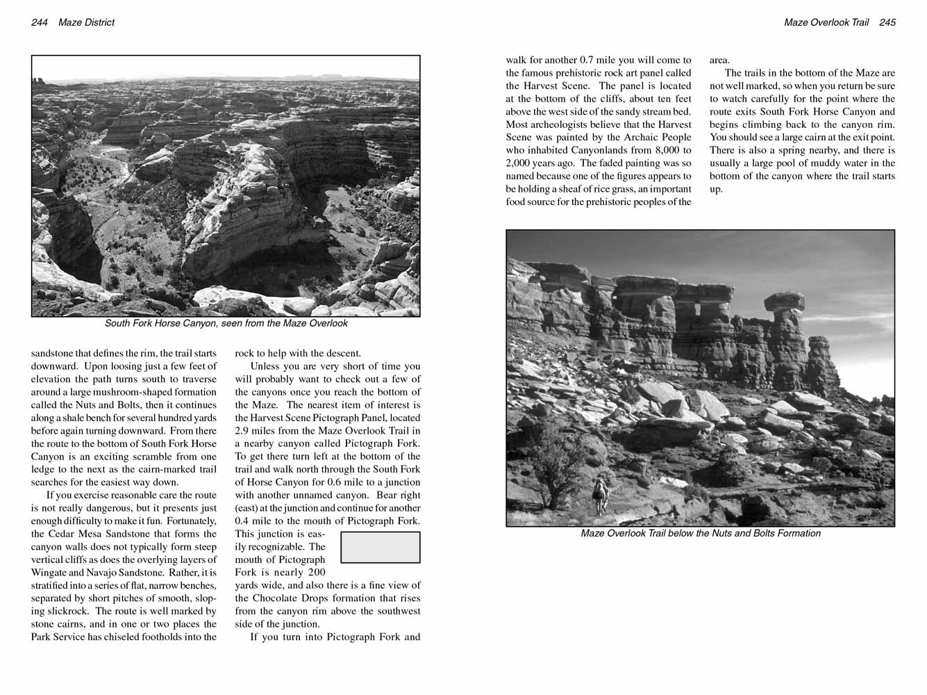 From the parking lot at the end of the road a well marked trail proceeds across the slickrock to the edge of the abyss.
Then, after finding a break in the hard, white sandstone that defines the rim, the
Maze Overlook trail starts downward.
Upon loosing just a few feet of elevation the path turns south to traverse around a large mushroom-shaped formation called the Nuts and Bolts,
then it continues along a shale bench for several hundred yards before again turning downward.
From there the route to the bottom of South Fork Horse Canyon is an exciting scramble from one ledge to the next as the cairn-marked
Maze Overlook trail searches for the easiest way down.
If you exercise reasonable care the route is not really dangerous, but it presents just enough difficulty to make it fun.
Fortunately, the Cedar Mesa Sandstone that forms the canyon walls does not typically form steep vertical cliffs as does the overlying layers of Wingate and Navajo Sandstone.
Rather, it is stratified into a series of flat, narrow benches, separated by short pitches of smooth, sloping slickrock.
The route is well marked by stone cairns, and in one or two places the Park Service has chiseled footholds into the rock to help with the descent.
Unless you are very short of time you will probably want to check out a few of the canyons once you reach the bottom of the Maze.
The nearest item of interest is the Harvest Scene Pictograph Panel, located 2.9 miles from the Maze Overlook Trail in a nearby canyon called Pictograph Fork.
To get there turn left at the bottom of the trail and walk north through the South Fork of Horse Canyon for 0.6 mile to a junction with another unnamed canyon.
Bear right (east) at the junction and continue for another 0.4 mile to the mouth of Pictograph Fork. This junction is easily recognizable.
The mouth of Pictograph Fork is nearly 200 yards wide, and also there is a fine view of the Chocolate Drops formation that rises from the canyon rim above the southwest side of the junction.
If you turn into Pictograph Fork and walk for another 0.7 mile you will come to the famous prehistoric rock art panel called the Harvest Scene.
The panel is located at the bottom of the cliffs, about ten feet above the west side of the sandy stream bed.
Most archeologists believe that the Harvest Scene was painted by the Archaic People who inhabited Canyonlands from 8,000 to 2,000 years ago.
The faded painting was so named because one of the figures appears to be holding a sheaf of rice grass, an important food source for the prehistoric peoples of the area.
The trails in the bottom of the Maze are not well marked,
so when you return be sure to watch carefully for the point where the route exits South Fork Horse Canyon and begins climbing back to the canyon rim.
You should see a large cairn at the exit point. There is also a spring nearby, and there is usually a large pool of muddy water in the bottom of the canyon where the
Maze Overlook trail starts up.
Note to web developers: You may copy this material onto your site, but in return please include a link to my home page
www.utahtrails.com. Thank you, David Day (utahdavidday at gmail.com)
Click here to see more trails in
Canyonlands National Park
© Rincon Publishing Company, all rights reserved
|


 There is no better place in Canyonlands National Park to view the incredibly rugged expanse of the Maze than the Maze Overlook.
The loneliness and serenity of this point, combined with the tortuously etched canyons below make it one of the grandest panoramas in the park.
The five-mile stretch of land between the overlook and the Green River is an amazing work of art, tenaciously sculpted by eons of rainwater searching for a way to the sea.
 From the parking lot at the end of the road a well marked trail proceeds across the slickrock to the edge of the abyss.
Then, after finding a break in the hard, white sandstone that defines the rim, the
Maze Overlook trail starts downward.
Upon loosing just a few feet of elevation the path turns south to traverse around a large mushroom-shaped formation called the Nuts and Bolts,
then it continues along a shale bench for several hundred yards before again turning downward.
From there the route to the bottom of South Fork Horse Canyon is an exciting scramble from one ledge to the next as the cairn-marked
Maze Overlook trail searches for the easiest way down.