Island District
Overview
excerpted from our book
Canyonlands National Park
Favorite Jeep Roads & Hiking Trails
page 22
|
Buy book directly from the author!
Canyonlands National Park
Favorite Jeep Roads & Hiking Trails
- has access info for 75 trailheads
- 56 detailed trail maps
- 241 photographs
- loads of driving and hiking tips
|
regularly $14.95
now on sale for only
$11.95
click here
for book orders
|


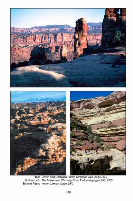
There is no better introduction to Canyonlands National Park than the panoramic roadside vistas in the Island in the Sky District. This section of the park is dominated by a long, narrow promontory of land called the Island in the Sky Mesa that protrudes into the canyons from the north. A paved road follows the mesa top all the way to its southern end, and along the way it passes several remarkable viewpoints that should not be missed. The air is so clean that mountains fifty miles away appear as jagged purple cutouts on the distant horizon. The Green and Colorado Rivers wind through deep gorges 2000 feet below the mesa, while the intervening canyons are filled with a profusion of buttes, pinnacles, and plateaus.
From Grandview Point, on the southern tip of Island in the Sky Mesa, you can see many prominent landmarks in all three districts of the park. This is also a good place to study the geology of the area and gain some appreciation for the forces that created the canyons. Directly below the mesa is a sheer 600-foot cliff of Wingate Sandstone. Beneath that you will see a sloping layer of shale and mudstone, after which the land levels off onto a wide bench called the White Rim Plateau.
The White Rim Plateau figures prominently in the history of Canyonlands. This benchland was a popular winter grazing pasture for both sheep and cattle from the 1890s until the early 1960s, and many of the trails described on the following pages were originally built by ranchers in order to gain access to the plateau. Local cowboys originally called this area Between the Rivers, and the top of the mesa was usually referred to as Grays Pasture. It was only after the national park was created that it was renamed the Island in the Sky.
The White Rim Plateau was also used as an access corridor by prospectors during the uranium boom of the early 1950s. Most of the prospecting was done just above the White Rim Plateau in the Chinle Formation, and it was the uranium miners and prospectors that built the White Rim Road. Today the White Rim Road is one of the most popular jeep trails in Utah. It can clearly be seen winding across the White Rim Plateau from most of the Island in the Sky viewpoints.
In most places the White Rim Sandstone, which supports the White Rim Plateau, lies a thousand feet above the Colorado and Green Rivers. But in the northwest corner of the park the White Rim Formation actually dips below the Green River, causing the nature of the river canyon to change drastically. Upstream from that point the river is much more approachable, with many wide fertile soil deposits, called bottoms, along its shores.
These river bottoms played an important role in the history of Canyonlands. They were frequently used by early cattle ranchers, and many of the bottoms were homesteaded by early settlers. The prehistoric Anasazi and Fremont Indians also had settlements on some of the river bottoms, as evidenced by the granaries and other artifacts they left behind.
Note to web developers: You may copy this material onto your site, but in return please include a link to my home page
www.utahtrails.com. Thank you, David Day (utahdavidday at gmail.com)
Click here to see more trails in
Canyonlands National Park
© Rincon Publishing Company, all rights reserved
|


