|
Links to other sites:
Do you have any recent information to add about this trail?
Ordering books & Maps
Free sample copies of Outdoor Magazines
Comments about this site or our book:

|
This is probably the best known
hike in Utah. The watery North Fork Virgin River Canyon offers
a welcome respite from Southern Utah’s hot summer weather,
and the scenery within the canyon is truly spectacular. There
are only about three months of the year, however, when conditions
are suitable for the hike, and a fair amount of planning is required
for a successful trip.
The most important consideration
is the weather. Flash floods are a constant danger in narrow
desert canyons like the Zion Narrows, and you shouldn’t
begin the narrows hike unless the forecast is good. The North
Fork Virgin River drains several hundred square miles, and during
a thunder storm the water level inside the canyon can rise several
feet in a matter of minutes. At least five hikers have already
drown in the Zion Narrows after being caught in flash floods,
and because of this danger the Park Service no longer allows
hikers to spend more than one night on the river. Also, it will
not issue permits to walk the route before the 3:00 p.m. weather
report is issued the day before the hike begins.
Another point to consider is the
popularity of this hike and the limited camping facilities. There
are only 12 allowed camp sites within the canyon, and they are
filled almost every night during the summer. The camp sites are
assigned on a first-come-first-served basis beginning at 3:00
p.m. each day, so if you want to be assured of getting an overnight
permit you should be at the Visitor Center by at least 1:00 p.m.
the day before your hike. The sites are assigned according to
your group size. Most of the sites will accommodate 4 to 6 people,
but only one site is large enough for the maximum group size
of 12 people. In addition to the overnight permits, the Park
Service also hands out up to 80 permits each afternoon for day
hikes through the narrows.
Day 1
Cross the North Fork Virgin River
at the car parking area on Chamberlain’s Ranch and continue
following the jeep road on foot above the south side of the river.
This is a beautiful hiking area with rolling hills, scattered
trees and large grassy fields along the river, but bear in mind
that it is all private property, accessible to hikers only by
prior agreement with the owners. You won’t actually be on
National Park Service land for nearly seven miles. The owners
have requested that hikers not camp on their land and not walk
across their fields or disturb their cattle. If the ranchers’
private property is not respected there could come a day when
hikers are no longer allowed access into this area, so please
follow the rules.
After walking 2.5 miles along the
jeep road you will come to Bulloch’s Cabin, an old abandoned
homestead on the south side of the road. Remarkably, the cabin
is still in reasonably good condition. There are also a few pieces
of old farming machinery lying about the area. The road finally
ends 0.3 mile beyond Bulloch’s Cabin, and a trail continues
along the river. Soon the river begins its descent into the canyon
which you will follow all the way to the end of the hike.
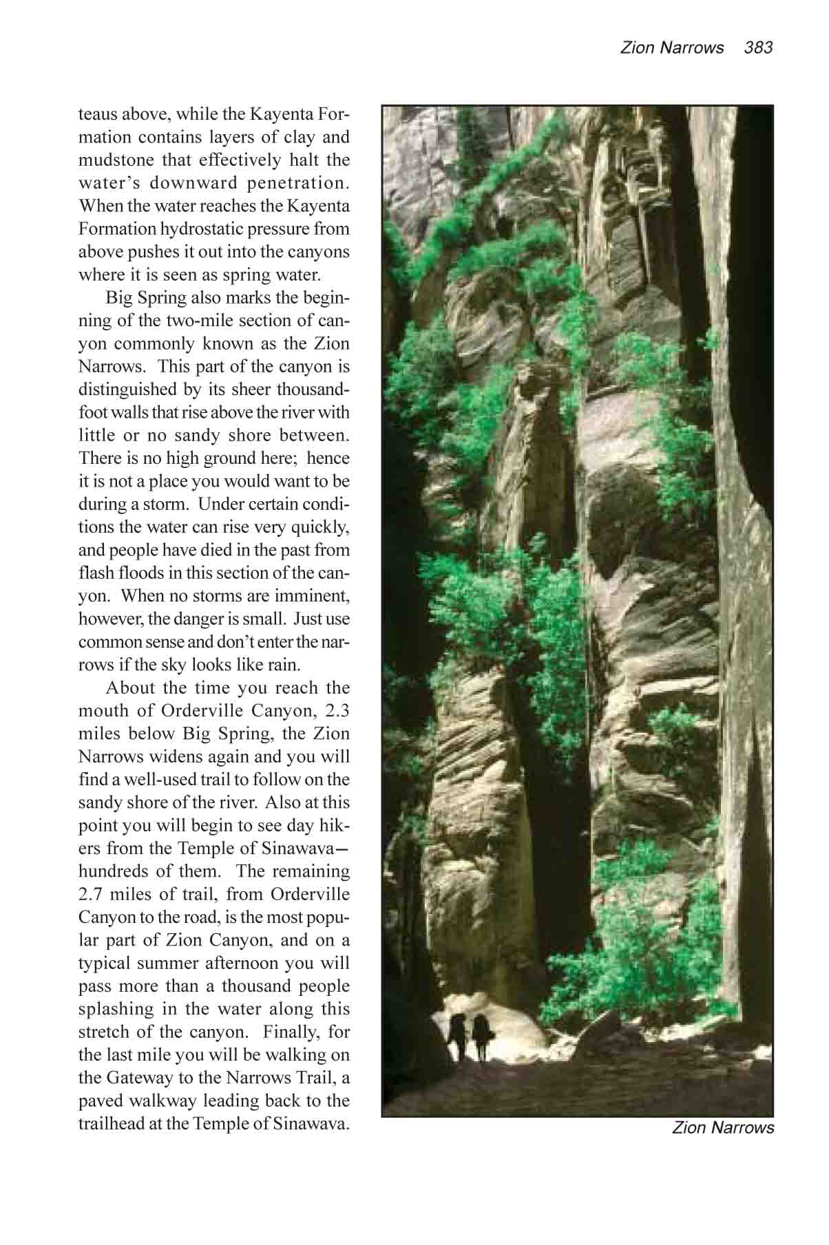
The North Fork Canyon is a canyon
full of surprises, and for the rest of the day you can count
on being awed and inspired over and over again. Frequently the
canyon will appear to end at the base of an impenetrable cliff
a hundred feet ahead, but it always turns at the last minute
to find a way around the obstacle. Often you will see large trees
and other debris that have been washed into the canyon from previous
flash floods. But the way around these obstructions is usually
easy and very little scrambling is necessary. Because of the
large number of hikers that pass through the canyon the easiest
route is generally well defined.
You will come to the first long
stretch of really good canyon narrows near the park boundary,
about three miles after you first enter the canyon. The canyon
rim at this point is 800 feet above the streambed, and the walls
at the bottom are often no more than fifteen feet apart. The
first campsite, Maple Camp, is also located in this area, at
a well marked location on the left shore about 8 feet above the
water.
The next point of interest in the
canyon is a small waterfall. About 1.6 miles below Maple Camp
the stream suddenly plunges over a 20-foot dam in the canyon
floor. Occasionally a daring hiker will take off his backpack
and jump over the fall into the pool below, but to do so is foolhardy.
First of all it is impossible to see what rocks might lie below
the boiling water, and second, it is hard to imagine a more inconvenient
place to sustain an injury. Don’t take the chance. There
is an easy way around the waterfall on the south side of the
canyon.
Deep Creek joins the North Fork
at a wide confluence 0.8 miles below the waterfall. Beyond this
point you will notice a large change in the flow rate of the
river; about two thirds of the water flowing through the Zion
Narrows comes from Deep Creek. This canyon offers a popular side
trip and you may want to spend some time exploring-especially
if your assigned campsite is the Deep Creek Camp, located at
the confluence.
The other ten campsites are all
located in the next 2.5 miles downstream from Deep Creek. Unfortunately
the Park Service does not allow hikers to stipulate which site
they want, but if I were given the opportunity to pick one I
would probably choose the Kolob Creek Camp, 0.9 mile below Deep
Creek. This campsite is located on a high shaded bench, just
south of the Kolob Creek confluence. The site is very pretty,
but what makes it especially attractive is its proximity to Kolob
Canyon-the most interesting of all the Zion Narrows side canyons.
If you have a few extra hours to spend exploring on your way
through the narrows this is a good place to spend it. Kolob Canyon
is one of the best examples in Utah of a deep, narrow slot canyon.
Day 2
The next side canyon you will pass
is Goose Creek Canyon, which merges into Zion Canyon 1.3 miles
below Kolob Creek. Goose Creek also provides a good opportunity
for side trips. It is a wider canyon than Kolob, with more vegetation
in the bottom. Goose Creek joins the North Fork on the west side
of the river near campsite number 10, the Alcove Camp.
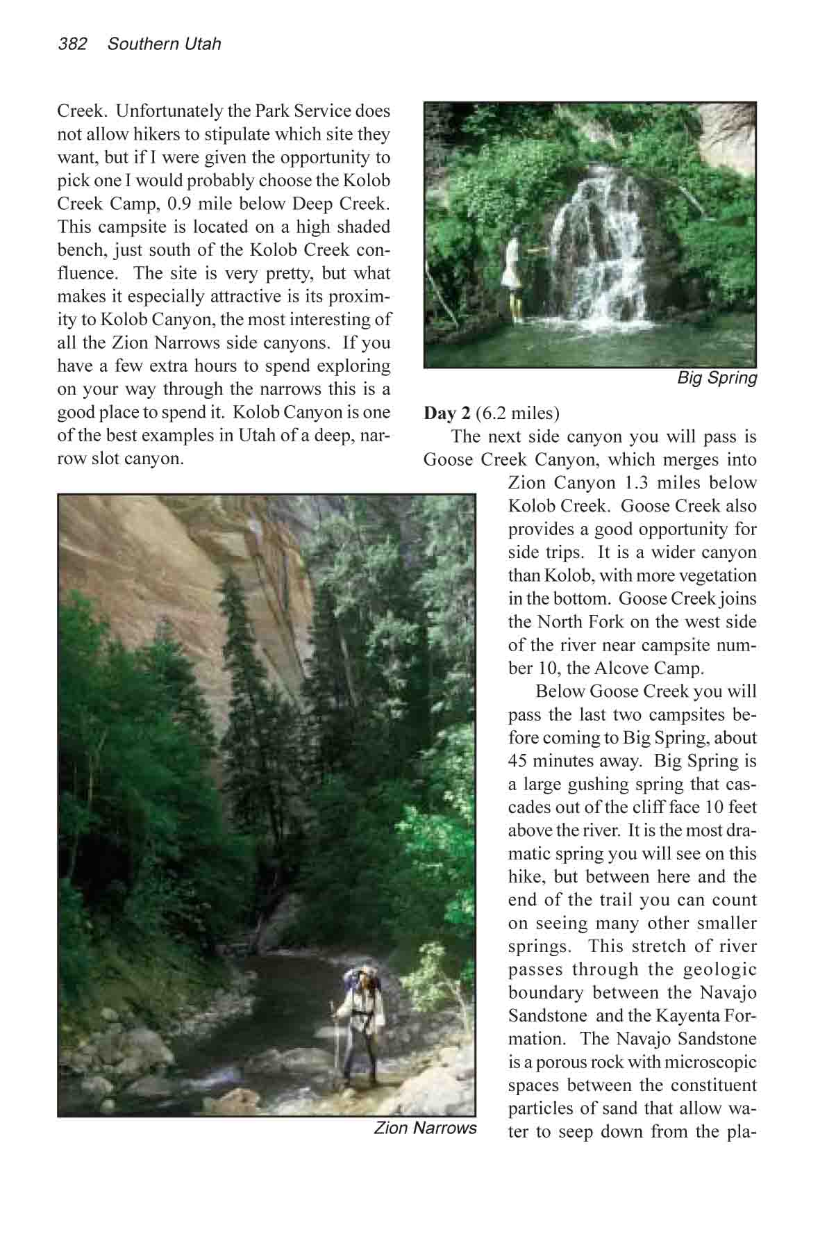
Below Goose Creek you will pass
the last two campsites before coming to Big Spring, about 45
minutes away. Big Spring is a large gushing spring that cascades
out of the cliff face 10 feet above the river. It is the most
dramatic spring you will see on this hike, but between here and
the end of the trail you can count on seeing many other smaller
springs. This stretch of river passes through the geologic boundary
between the Navajo Sandstone and the Kayenta Formation. The Navajo
Sandstone is a porous rock with microscopic spaces between the
constituent particles of sand that allow water to seep down from
the plateaus above, while the Kayenta Formation contains layers
of clay and mudstone that effectively halt the water’s downward
penetration. When the water reaches the Kayenta Formation hydrostatic
pressure from above pushes it out into the canyons where it is
seen as spring water.
Big Spring also marks the beginning
of the two-mile section of canyon commonly known as the Zion
Narrows. This part of the canyon is distinguished by its sheer
thousand-foot walls that rise above the river with little or
no sandy shore between. There is no high ground here; hence it
is not a place you would want to be during a storm. Under certain
conditions the water can rise very quickly, and people have died
in the past from flash floods in this section of the canyon.
When no storms are imminent, however, the danger is small. Just
use common sense and don’t enter the narrows if the sky
looks like rain.
About the time you reach the mouth
of Orderville Canyon, 2.3 miles below Big Spring, the Zion Narrows
widens again and you will find a well-used trail to follow on
the sandy shore of the river. Also at this point you will begin
to see day hikers from the Temple of Sinawava-hundreds of them.
The remaining 2.7 miles of trail, from Orderville Canyon to the
road, is the most popular part of Zion Canyon, and on a typical
summer afternoon you will pass more than a thousand people splashing
in the water along this stretch of the canyon. Finally, for the
last mile you will be walking on the Gateway to the Narrows Trail,
a paved trail leading back to the congested parking lot at the
once serene Temple of Sinawava. |