|
Links to other sites:
Ordering books & Maps
Comments about this site or our book:

|
Anyone who has visited Canyonlands
or Arches National Parks in the early summer has probably gazed
admiringly at the snow capped peaks of the La Sal Mountains.
The sight of snow seems oddly out of place in the midst of the
desert heat, but snow is usually visible on the higher summits
of the La Sals well into July. Tradition has it that the mountains
were named by Silvestre Valez de Escalante, the Spanish missionary
and explorer, who saw them during his expedition through Utah
in 1776. He called them the Sierra La Sal, or “Salt Mountains”
because he deemed it so unlikely that they could be covered with
snow so late in the summer.
As small and isolated as the La
Sal Range is, it is actually the second highest mountain range
in Utah. Only northern Utah’s Uinta Mountains are higher.
The highest point in the La Sals is Mount Peale (12,721 feet),
but the most celebrated peak is the one with the most unpronounceable
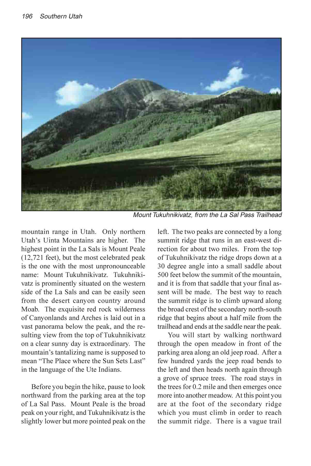
name: Mount Tukuhnikivatz. Tukuhnikivatz is prominently situated
on the western side of the La Sals and can be easily seen from
the desert canyon country around Moab (see photograph, page 209).
The exquisite red rock wilderness of Canyonlands and Arches is
laid out in a vast panorama below the peak, and the resulting
view from the top of Mount Tukuhnikivatz on a clear sunny day
is extraordinary. The mountain’s tantalizing name is supposed
to mean “The Place where the Sun Sets Last” in the
language of the Ute Indians.
Before you begin the hike, pause
to look northward from the parking area at the top of La Sal
Pass. Mount Peale is the broad peak on your right, and Mount
Tukuhnikivatz is the slightly lower but more pointed peak on
the left. The two peaks are connected by a long summit ridge
that runs in an east-west direction for about two miles. From
the top of Mount Tukuhnikivatz the ridge drops down at a 30 degree
angle into a small saddle about 500 feet below the summit of
the mountain, and it is from that saddle that your final assent
will be made. The best way to reach the summit ridge is to climb
upward along the broad crest of the secondary north-south ridge
that begins about a half mile from the trailhead and ends at
the saddle near the peak.
You will start by walking northward
through the open meadow in front of the parking area along an
old jeep road. After a few hundred yards the jeep road bends
to the left and then heads north again through a grove of spruce
trees. The road stays in the trees for 0.2 mile and then emerges
once more into another meadow. At this point you are at the foot
of the secondary ridge which you must climb in order to reach
the summit ridge. There is a vague trail leaving the jeep road
and heading into the trees at the foot of the ridge, but the
trail is difficult to find. Instead of wasting time looking for
it just continue walking northward along the jeep road. The road
follows the eastern side of the ridge for another 0.4 mile before
it ends. When the road ends simply turn west and start climbing
until you reach the crest of the ridge. The crest of the ridge
is about 500 feet above the road at this point. It is a tiring
climb, but at least there are no trees to hinder your progress.
When you reach the top of the secondary
ridge you will find a trail that climbs along its crest to the
summit ridge above. The route is very steep, but there are few
obstacles. The trail finally reaches the Peale-Tukuhnikivatz
summit ridge about 0.5 mile east of Mount Tukuhnikivatz, where
once again you will be on relatively level ground. What a relief!
The elevation is just over 12,000 feet, and the ground is covered
with the grasses, mosses, and wild flowers of the Arctic-Alpine
Tundra life zone. This area is part of the Mount Peale Research
Natural Area, an area that was established in the 1980s to protect
several species of endangered plants that occupy the above-treeline
slopes of the La Sals. Try to tread gently across the tundra-especially
if you are in a large group.
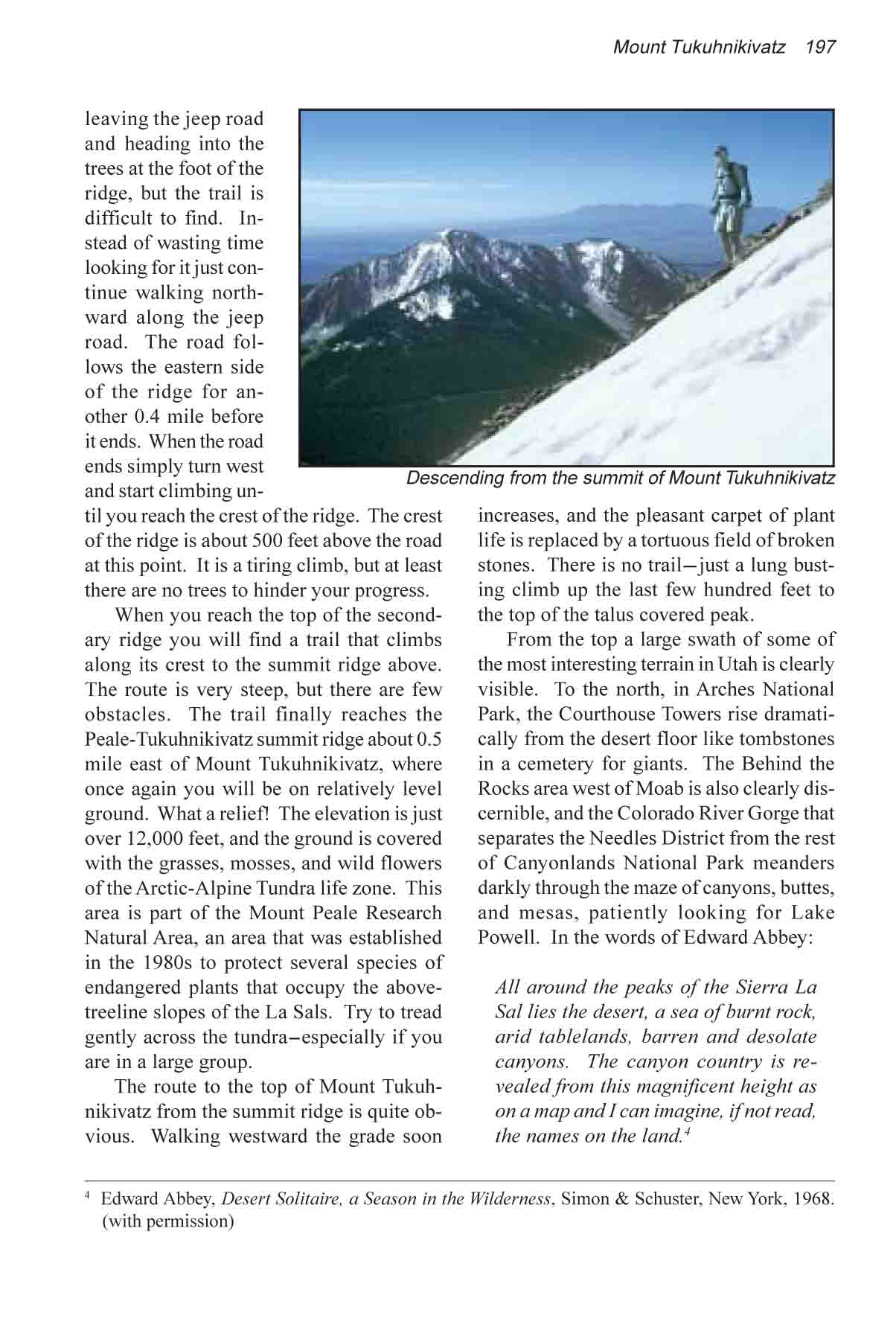
The route to the top of Mount Tukuhnikivatz
from the summit ridge is quite obvious. Walking westward the
grade soon increases, and the pleasant carpet of plant life is
replaced by a tortuous field of broken stones. There is no trail-just
a lung busting climb up the last few hundred feet to the top
of the talus covered peak.
From the top a large swath of some
of the most interesting terrain in Utah is clearly visible. To
the north, in Arches National Park, the Courthouse Towers rise
dramatically from the desert floor like tombstones in a cemetery
for giants. The Behind the Rocks area west of Moab is also clearly
discernible, and the Colorado River Gorge that separates the
Needles District from the rest of Canyonlands National Park meanders
darkly through the maze of canyons, buttes, and mesas, patiently
looking for Lake Powell. In the words of Edward Abbey:
"All around the peaks of the Sierra La Sal lies the
desert, a sea of burnt rock, arid tablelands, barren and desolate
canyons. The canyon country is revealed from this magnificent
height as on a map and I can imagine, if not read, the names
on the land." (Desert Solitaire, a Season in the
Wilderness, Simon & Schuster, New York, 1968)
|