|
Links to other sites:
Do you have any recent information to add about this trail?
Ordering books & Maps
Free sample copies of Outdoor Magazines
Comments about this site or our book:

|
The Pine Valley Mountains are
located in the extreme southwestern corner of Utah, on the geologic
boundary of the Colorado Plateau and the Great Basin. Like most
other ranges in the Great Basin they are very dry and contain
no significant lakes. They do, however, contain a number of small
creeks and meadows which, at least during the early weeks of
summer, are extremely scenic. Unfortunately, most of the water
disappears soon after the winter snow has melted. The best time
to attempt this hike is during the month of June, when the meadows
are usually green and full of water. As midsummer approaches
they soon dry up and the hike becomes much less appealing.
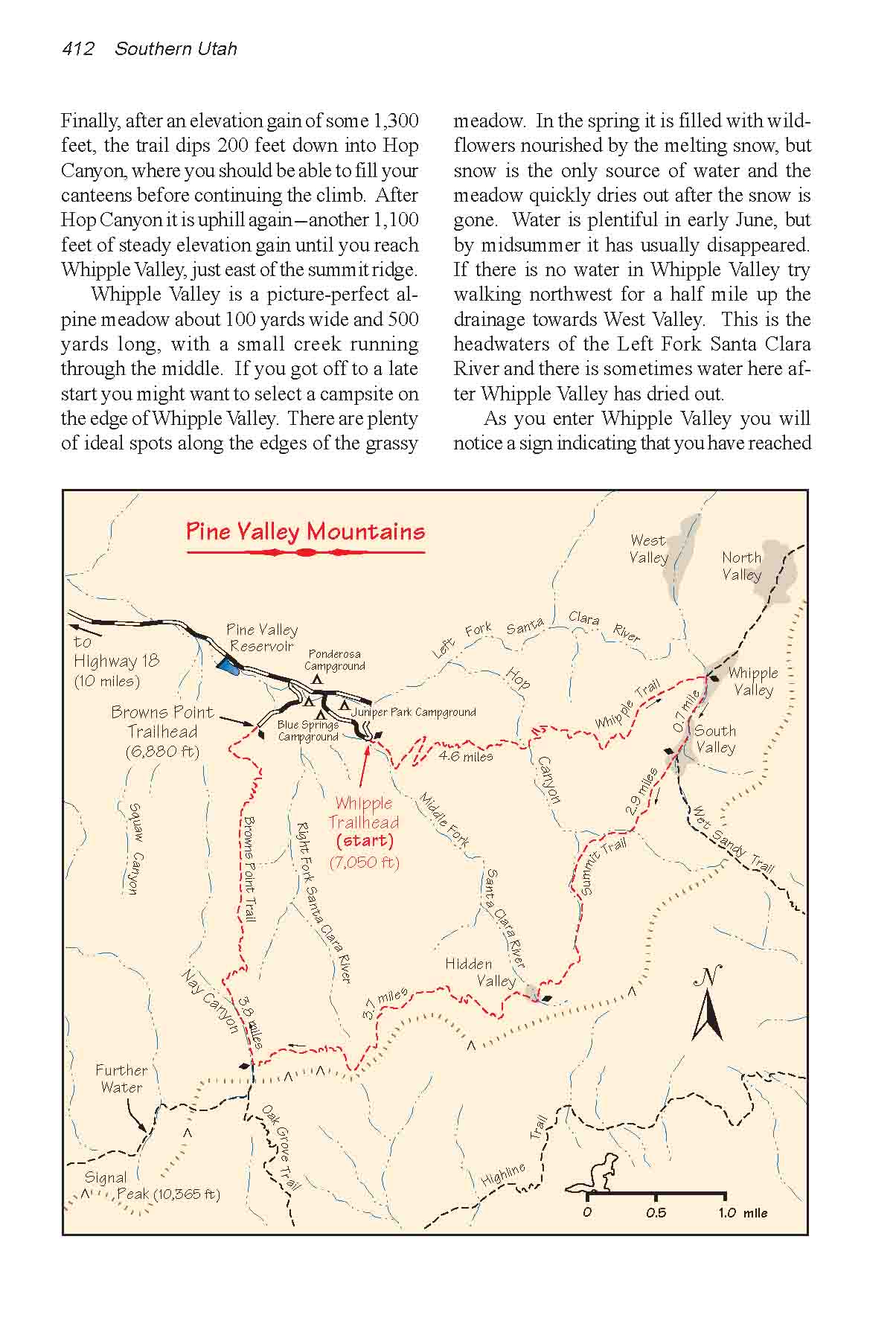
Although this hike is only 15.7
miles long there is a great deal of up-and-down along the way,
and many people prefer to spend a second night along the trail.
If you elect to do this you will have no trouble finding good
campsites all along the Summit Trail between Whipple Valley and
Nay Canyon. You can camp near water at Whipple Valley, South
Valley, Hop Canyon, Hidden Valley or Nay Canyon.
Day 1
From Whipple Trailhead the trail
starts upward immediately, climbing steadily over the next two
miles through a forest dominated by subalpine fir and Engelmann
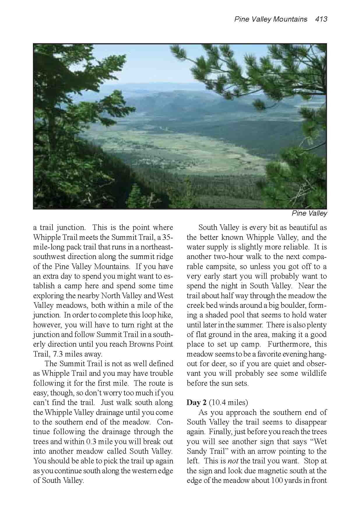
spruce. You will want to stop frequently to enjoy the magnificent
views of Pine Valley Town below and the hills that surround it.
Finally, after an elevation gain of some 1,300 feet, the trail
dips 200 feet down into Hop Canyon, where you should be able
to fill your canteens before continuing the climb. After Hop
Canyon it is uphill again-another 1,100 feet of steady elevation
gain until you reach Whipple Valley, just east of the summit
ridge.
Whipple Valley is a picture-perfect
alpine meadow about 100 yards wide and five times as long, with
a small creek running through the middle. If you got off to a
late start you might want to select a campsite on the edge of
Whipple Valley. There are plenty of ideal spots along the edges
of the grassy meadow. In the spring it is filled with wildflowers
nourished by the melting snow, but snow is the only source of
water and the meadow quickly dries out after the snow is gone.
Water is plentiful in early June, but by midsummer it has usually
disappeared. If there is no water in Whipple Valley try walking
northwest for a half mile up the drainage towards West Valley.
This is the headwaters of the Left Fork Santa Clara River and
there is sometimes water here after Whipple Valley has dried
out.
As you enter Whipple Valley you
will notice a sign indicating that you have reached a trail junction.
This is the point where Whipple Trail meets the Summit Trail,
a 35-mile-long pack trail that runs in a northeast-southwest
direction along the summit ridge of the Pine Valley Mountains.
If you have an extra day to spend you might want to establish
a camp here and spend some time exploring the nearby North Valley
and West Valley meadows, both within a mile of the junction.
In order to complete this loop hike, however, you will have to
turn right at the junction and follow Summit Trail in a southerly
direction until you reach Browns Point Trail, 7.3 miles away.
The Summit Trail is not as well
defined as Whipple Trail and you may have trouble following it
for the first mile. The route is easy, though, so don’t
worry too much if you can’t find the trail. Just walk south
along the Whipple Valley drainage until you come to the southern
end of the meadow. Continue following the drainage through the
trees and within 0.3 mile you will break out into another meadow
called South Valley. You should be able to pick the trail up
again as you continue south along the western edge of South Valley.
South Valley is every bit as beautiful
as the better known Whipple Valley, and the water supply is slightly
more reliable. It is another two-hour walk to the next comparable
campsite, so unless you got off to a very early start you will
probably want to spend the night in South Valley. Near the trail
about half way through the meadow the creek bed winds around
a big boulder, forming a shaded pool that seems to hold water
until later in the summer. There is also plenty of flat ground
in the area, making it a good place to set up camp. Furthermore,
this meadow seems to be a favorite evening hangout for deer,
so if you are quiet and observant you will probably see some
wildlife before the sun sets.
Day 2
As you approach the southern end
of South Valley the trail seems to disappear again. Finally,
just before you reach the trees you will see another sign that
says “Wet Sandy Trail” with an arrow pointing to the
left. This is not the trail you want. Stop at the sign and look
due magnetic south at the edge of the meadow about 100 yards
in front of you. If you look carefully you will see another trail,
the Summit Trail, entering the trees on the south end of the
meadow. There are also well defined blaze marks on the trees
where the trail leaves the meadow. Once you enter the woods the
trail is again quite will defined.
Immediately after you leave South
Valley the Summit Trail again begins to climb. Over the next
2.9 miles you will first gain 220 feet in elevation, then drop
420 feet, then gain 400 feet, then loose 420 feet before finally
reaching what, in my opinion, is the most beautiful meadow of
all: Hidden Valley. Located at the foot of a rocky outcrop near
the headwaters of the Middle Fork Santa Clara River, Hidden Valley
is indeed well hidden. The meadow is small, only 100 yards in
diameter, and it is completely surrounded by tall, stately Engelmann
spruce. You will hardly know it is there before you walk into
it. Adding to the effect, Summit Trail exits the meadow through
a partially hidden five-foot-wide crack in the rock barrier on
its western side-a perfect secret entrance to an outlaws’
hideout. If you are looking for quiet seclusion there are no
better places to camp than Hidden Valley.
Continuing its up-and-down route,
the Summit Trail climbs nearly a thousand feet above Hidden Valley,
and then drops 320 feet back down to Nay Canyon, wherein is located
the junction with Browns Point Trail. Nay Canyon generally has
water in it in early summer, and it is a good place to camp or
refill your canteens.
In order to complete this loop
you must leave the Summit Trail at the Nay Canyon Junction and
take Brown Point Trail back to the Pine Valley Recreation Area.
Again, however, if you have an extra day to spend there are a
number of points of interest further up the Summit Trail. Continuing
south on Summit Trail for 1.3 miles from the junction will bring
you to Further Water, a good water source and a popular camping
area. Two miles from the junction Summit Trail passes within
0.2 mile of Signal Peak (10,365 ft.), the highest point in the
Pine Valley Mountains. The peak is about 370 feet above the trail,
and there is no trail to the summit. The climb, however, is not
technically difficult.
From its junction with the Summit
Trail, Browns Point Trail follows the bottom of Nay Canyon for
0.7 mile before climbing 400 feet back up the ridge on the east
side of the canyon and then following the ridge the rest of the
way to the bottom. The total amount of elevation loss along the
trail from the junction is a knee busting 3,120 feet, but you
will be compensated by fine views of the valley below. You can
see Pine Valley for almost the entire distance. |

