|
Links to other sites:
Ordering books & Maps
Comments about this site or our book:

|
If the strange and wonderful rock
formations of southern Utah interest you, you will love this
hike. Devils Garden contains eight of the best known sandstone
arches in Arches National Park, including Landscape Arch, the
park's longest span. The area is a particularly good place to
study the life cycle of natural arches. You will see many spans
of different ages as you wander through the jumbled canyons of
stone. On the return portion of the loop you will pass through
a giant maze of long vertical sandstone fins, all parallel to
one another with narrow canyons between. These fins are the raw
materials from which future arches are being made. In another
million years, when all of the present arches are gone, there
will be many new ones in these canyons to replace them. Some
of the new arches might even be more spectacular than the present
ones. Although we mortals are allowed only a fleeting glimpse
of her current display, Nature is continually modifying and replacing
her artwork.
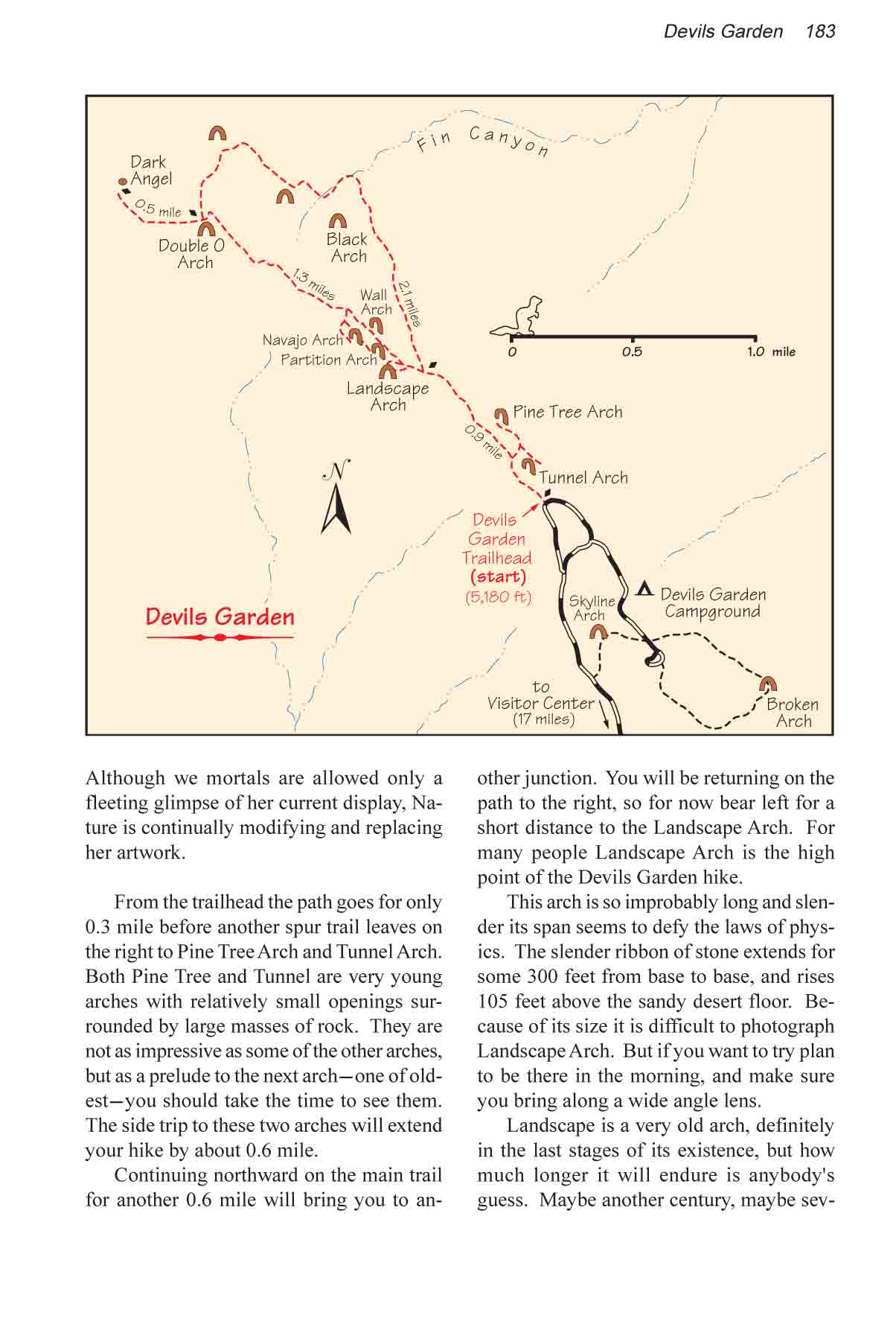
From the trailhead the path
goes for only 0.3 mile before another spur trail leaves on the
right to Pine Tree Arch and Tunnel Arch. Both Pine Tree and Tunnel
are very young arches with relatively small openings surrounded
by large masses of rock. They are not as impressive as some of
the other arches, but as a prelude to the next arch-one of oldest-you
should take the time to see them. The side trip to these two
arches will extend your hike by about 0.6 mile.
Continuing northward on the main
trail for another 0.6 mile will bring you to another junction.
You will be returning on the path to the right, so for now bear
left toward Landscape Arch. Soon you will see a short loop trail
on the left leading to this well known landmark.
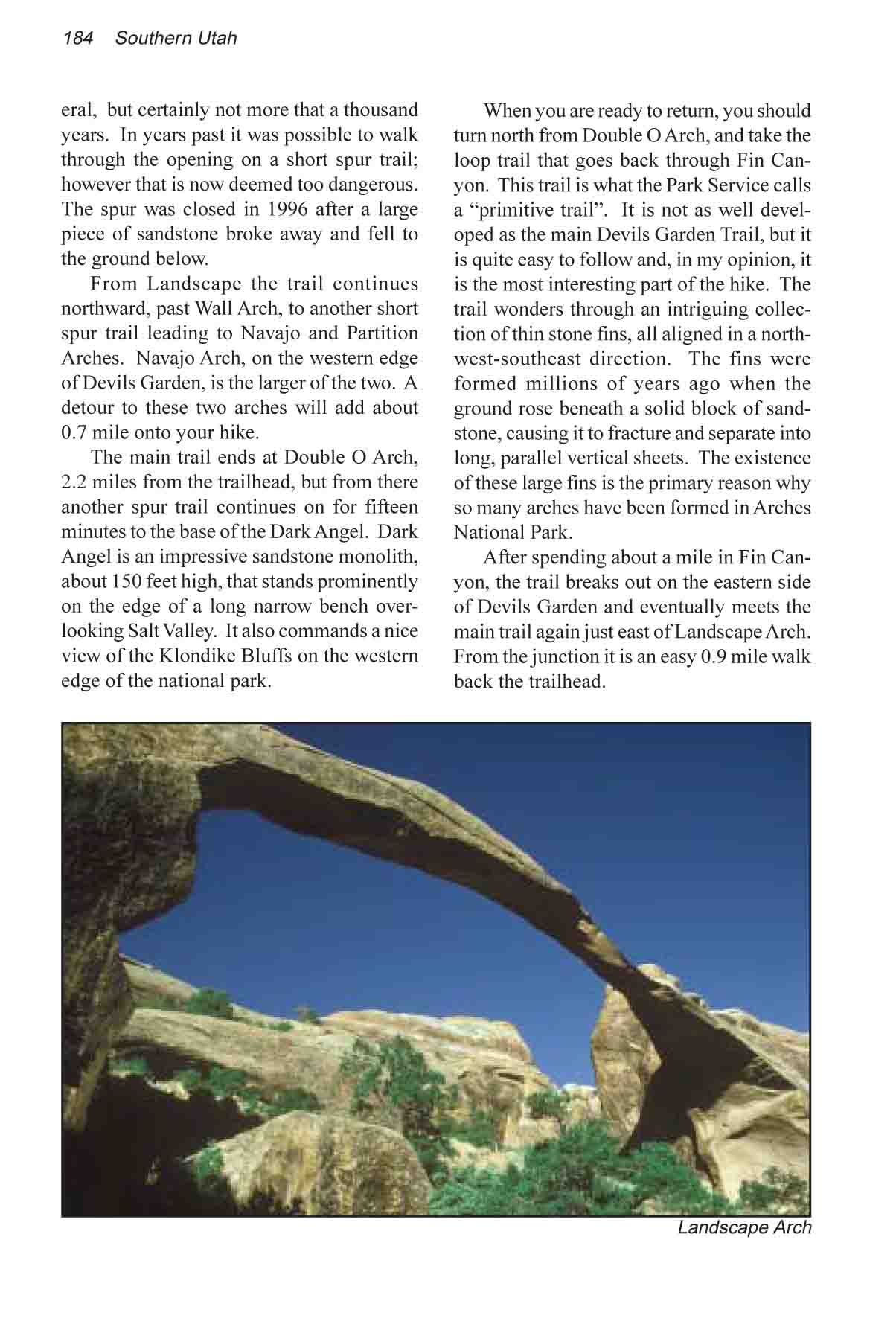
For most people, Landscape Arch
is the high point of the Devils Garden hike. The arch is so improbably
long and slender its span seems to defy the laws of physics.
The slender ribbon of stone extends for some 300 feet from base
to base, and rises 105 feet above the sandy desert floor. Landscape
is a very old arch, definitely in the last stages of its existence,
but how much longer will it endure? Maybe another century, maybe
several, but certainly not more that a thousand years. Because
of its size it is difficult to photograph Landscape Arch. But
if you want to try plan to be there in the morning, and make
sure you bring along a wide angle lens.
From Landscape Arch the trail continues
northward, past Wall Arch, to another short spur trail leading
to Navajo and Partition Arches. Navajo Arch, on the western edge
of Devils Garden, is the larger of the two. Visiting these two
arches will add about 0.7 mile onto your hike.
The main trail ends at Double O
Arch, 2.2 miles from the trailhead. From here another short trail
on the left goes to the base of the Dark Angel. Dark Angel is
a sandstone monolith, about 150 feet high, that stands prominently
on the edge of a long narrow bench overlooking Salt Valley. It
commands a nice view across the valley of the Klondike Bluffs,
on the western edge of the national park. The round trip to Dark
Angel will add another 1.0 mile to your hike.
When you are ready to return, you
should turn north from Double O Arch, and take the loop trail
that goes back through Fin Canyon. This trail is what the Park
Service calls a “primitive trail”. It is not as well
developed as the main Devils Garden Trail, but it is quite easy
to follow and, in my opinion, it is the most interesting part
of the hike. The trail wonders through an intriguing collection
of thin stone fins, all aligned in a northwest-southeast direction.
The fins were formed millions of years ago when the ground rose
beneath a solid block of sandstone, causing it to fracture and
separate into long, parallel vertical sheets. The existence of
these large fins is the primary reason why so many arches have
been formed in Arches National Park.
After spending about a mile in
Fin Canyon, the trail breaks out on the eastern side of Devils
Garden and eventually meets the main trail again just east of
Landscape Arch. From the junction it is an easy 0.9 mile walk
back the trailhead. |

